


 Article in PDF format
 How to cite this paper
An. 4. Enc. Energ. Meio Rural 2002
Brazilian solar resource atlas CD-ROM
Chigueru TibaI; Naum FraidenraichI; H. Grossi GallegosII; F.J.M. LyraIII
IDepartamento de Energia Nuclear, Universidade Federal de Pernambuco -UFPE, Av. Prof. Luiz Freire, 1000 - Cidade Universitária, 50.740-540 - Recife - PE
IIUniversidad Nacional de Luján, Buenos Aires, Argentina
IIICompanhia Hidro-Elétrica do São Francisco - CHESF - Recife - PE
ABSTRACT
The BRAZILIAN SOLAR RESOURCE ATLAS CD-ROM is intended to be a tool for solar system design, delivering information that relies on a large interactive database, including, also, a modern device for calculating the solar radiation collected by planes inclined at different tilt angles or tracking the sun around 1 or 2 axes. The spatial distribution of the daily solar radiation, monthly and yearly averaged, that hits Brazil is presented in 13 colored maps, together with the methodological procedures used for harmonizing the information and designing the maps. A map containing the location of pyranometric and actinographic terrestrial stations, the information which was used for designing the maps, is also presented. The period of collected data runs from 1978 to 1990. Similarly, the Atlas contains 13 colored maps, including daily insolation, monthly and yearly averaged, in addition to the map containing the location of the heliographic stations. The CD-ROM stores a database that includes over 500 stations located in Brazil and on the borders of its neighboring countries. The information is given either as daily, monthly average global solar radiation, or daily, monthly average insolation. A search device is included in the database, allowing to navigate over the maps or to select a desired location. The information may be printed as a report. The CD-ROM also includes a software to perform the following calculations: solar radiation estimates on a fixed plane at any inclination on North-South orientation; estimates of solar radiation collected by a plane tracking the sun about one or two axes; generation of synthetic series based on Markov's Transition Matrixes.
RESUMO
O CD ROM ATLAS SOLARIMÉTRICO DO BRASIL é um instrumento dedicado ao conhecimento e exploração do recurso solar no Brasil. Pretende-se, que o mesmo seja uma ferramenta que outorgue confiabilidade aos projetos de sistemas solares, seja pela disponibilização das informações mediante um extenso banco de dados interativo, como também pela inclusão de um moderno instrumento de cálculo da radiação solar incidente em planos com diferentes inclinações ou com acompanhamento do sol em 1 ou 2 eixos. A distribuição espacial da radiação solar diária, médias mensais e anuais incidente sobre o Brasil é apresentada em 13 mapas coloridos, juntamente com os procedimentos metodológicos utilizados para a harmonização das informações e elaboração dos mapas. O CD ROM contém uma base de dados com mais de 500 estações localizadas no Brasil e nas regiões limítrofes dos países vizinhos. São informações sobre radiação solar global diária, média mensal, ou insolação diária, média mensais. Está incluído no CD, um programa de computador que permite usar as informações da base de dados, para a realização dos seguintes cálculos: estimativas da radiação solar em um plano fixo, com orientação Norte-Sul e com inclinação qualquer; estimativas da radiação solar em um plano com acompanhamento do Sol em um e dois eixos; geração de séries sintéticas com a metodologia das matrizes de Markov (Matrix Transition Markov).
Palavras chaves: Radiação solar, Banco de Dados, Mapeamento do recurso solar, projeto de sistema solar, sistema solar fotovoltaico.
INTRODUCTION
Appropriate information about the solar resource is very important for a variety of technological areas, such as: agriculture, meteorology, forestry engineering, water resources and particularly for a new and growing technology like that associated to solar energy. The enlarged and sustained reproduction process of this energy, strongly depends on the economics and the reliability of the solar systems installed for demonstration purposes (within a restricted or wide scale). Those aspects are the result of a well-prepared project and consequently, from an accurate knowledge of the solar resource, which is not only a need but also an imperative for a large diffusion of the solar technology.
Existing sources of information about solar radiation in Brazil are quite large, involving a variety of institutions and publications on the subject. At the institutional level these sources are: the National Institute of Meteorology, secretaries of agriculture, research centers, universities, electric power generating and distributing companies, among others. The publications are available from institutional reports or scientific and technical magazines. Thus, the data quality vary considerably, including spatial and temporal discontinuities and lack of standardization of instruments as well as measurement units.
The general objective of this work was to recover, qualify, standardize and make available the best information on solar radiation resource - terrestrial data, in Brazil, in the form of Isoline Charts of Solar Radiation, Insolation and Numerical Tables (data base). Analytic summaries of a great part of the publications on the theme in the last forty years are also made available.
PROJECT BACKGROUND
In January 1993, under the coordination of the Electricity Research Center (Centro de Pesquisas de Energia Elétrica-CEPEL/ELETROBRÁS), a Working Group on Photovoltaic Solar Energy - GTEF was established. That Group had a national scope of coverage and was made up of companies from the electric sector, university research groups and manufacturers or representatives of photovoltaic equipment. At a GTEF meeting in 1993, it was decided to set up the Solar Resource Working Group under the coordination of the FAE Group-UFPE/DEFA-CHESF (Grupo de Pesquisas em Fontes Alternativas de Energia-Universidade Federal de Pernambuco/Companhia Hidro Elétrica do São Francisco). At the same time other working groups were also established (Engineering Manual, Certification and Regulation, Training, Promotion Strategy, Dissemination Policy and Photovoltaic Technology Data Base).
The Solar Resource Working Group (SRWG) elaborated and submitted a report to the GTEF, in May 1993, "Solar Resource in Brazil - Status and Proposals" (Lyra, et al, 1993), describing the critical situation regarding the information available on Solar Resource in Brazil and proposing measures that would enable the Group to overcome partially the appointed deficiencies. Among them, was the elaboration of a Solar Resource database for the country. That work would consist in organizing, classifying and standardizing measured and published data obtained by different authors and institutions over the last few decades. Such a compendium, together with new isoline maps of solar radiation would result in a Solar Resource Atlas for Brazil. It should be noted that existing data presented spatial and/or temporal fragmentation and standardization problems. Moreover, much of the solar radiation data, though published, are unavailable or almost inaccessible for most users, due to extremely low circulation of these publications (Project Reports, Masters Degree Dissertations, Internal Publications, Institutional Reports, among others). In light of the aforementioned considerations, the project to elaborate the National Solar Resource Atlas was submitted to CEPEL in 1994. The authors considered that the publication of the Atlas would make available an important database, which, as solar technology applications spread throughout Brazil, would make this subject become increasingly important.
Finally, in May 1996 FAE Group-UFPE/CEPEL signed an agreement with the purpose of elaborating the National Solar Resource Atlas.
BRAZILIAN SOLAR RESOURCE ATLAS CD-ROM
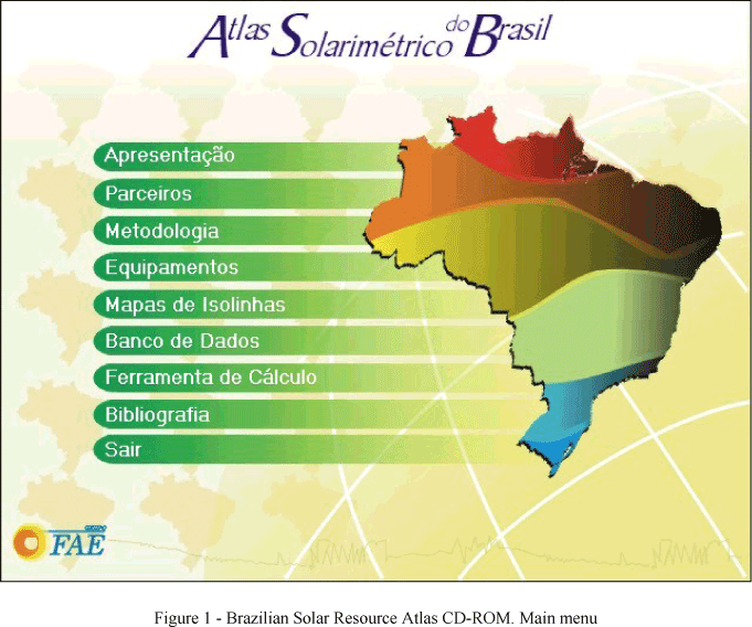
The Brazilian Solar Resource Atlas CD-ROM (Tiba et al, 2002) consists of four principal modules: Contour maps (methodology and maps), Solar radiation database, Solar radiation calculation tool and Solar radiation publications for Brasil. Fig. 1 show the main menu of the Atlas.
CONTOUR MAPS (METHODOLOGY AND MAPS)
The main purpose of the work, at this stage, is to reflect the global distribution of the resource, laying aside the particularities of the small and medium scale, and focussing on those of the macro scale.
Working with the possibilities presented by the available information, we sought to harmonize the original data, arising from different sources, recorded by a variety of instruments, covering different spatial extensions and subject to different treatments, to determine large zones, well differentiated, without losing track of the nature of the final product.
As a result, regions should appear where new measurements are necessary as they were not properly done in the past, others where it would prove to be convenient to increase the density of the measurement stations, and yet others where it would be necessary to check the instruments (so as to harmonize the collected values), or rationalize their distribution (where spatial coverage is exceedingly large).
Similar situations are also found throughout the world, with existing measurement networks not properly distributed. It is very difficult, if not impossible, to make compatible the necessity of information (ideal spatial distribution of stations) with the real (economic) possibilities of installing and maintaining such a network.
Finally, it is important to bear in mind that the choice of a location to install a system or a set of solar systems, supported by the quality of the solar resource (the solar radiation level seems adequate) should be carefully done, as average values are only a preliminary indication of the potential of that region. The ultimate choice will require detailed measurements at the location itself, to determine its value and principally its temporal variability.
The isoline charts were elaborated by using monthly and annual averages of daily global solar radiation, for the locations available in the data base. Those values were placed on national maps, under a polyconical projection centered at meridian 540 West, prepared on translucent paper at a 1:500,000 scale. Different symbols were used to identify the locations where either pyranometers or bimetallic actinographs were used. The values from estimates using different models (calculations with Angstrom correlation, e.g.) were left aside and used only exceptionally in cases of doubt during the isoline tracing process.
Each one of the 13 transparent maps (1 annual and 12 monthly) were overlaid on the hypsometric map of Brazil, prepared by the Brazilian Institute of Geography and Statistics (IBGE), with 200 m level differences.
The following general criteria were adopted for the preparation of the maps(Tiba el al, 2002):
- Considering that the errors, associated to the measurements using thermoelectric pyranometers coupled to electronic integrators that operate within a network, vary from 3% to 5%, depending on the model, and that daily recordings, on strips of paper, from the bimetallic actinographs may vary from 10 to 15% (as long as a reasonably good technical support is available), priority was given to information obtained with thermoelectric pyranometers.
- In somewhat homogeneous regions (assuming isotropy) the daily, monthly average pyranometric measurements, were extrapolated up to approximately 200 Km without running into errors greater than 10%, with a 90% confidence level.
- Average values of the solar radiation collected in neighboring countries were taken into account.
As a complementary measure, Pluviometric Charts of the Climatological Atlas of South America (OMM, 1975) prepared by the World Meteorological Organization (WMO) and vegetation covering maps of Brazil were used.
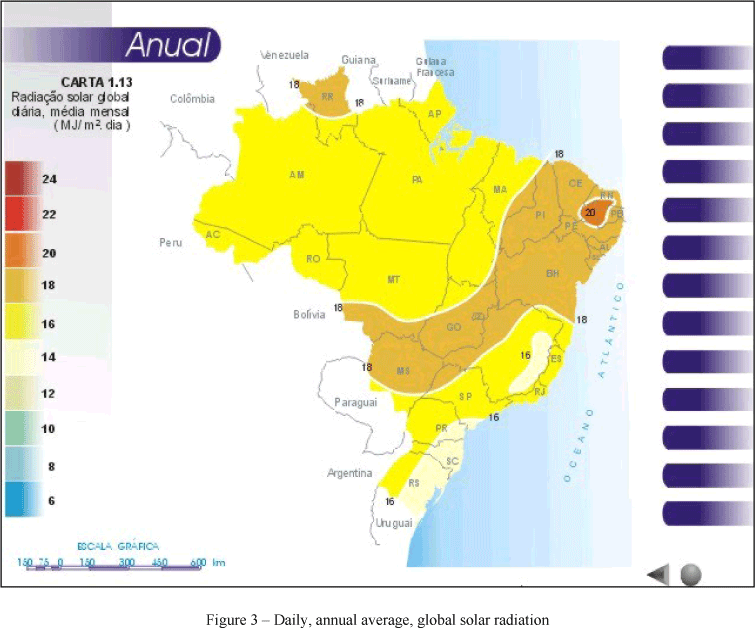
The values of the daily, monthly average and annual global solar radiation, were expressed in MJ/m2. As a matter of convention these numbers are located on the isolines, next to the rising values. The value of 2 MJ/m2 was established as the appropriate spacing between successive isolines. In regions where there was no information or where the information was not sufficiently reliable, the isolines were dashed.
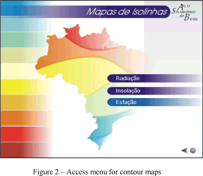
The Atlas contains 13 maps for daily monthly and annual average global solar radiation, 13 maps for daily monthly and annual average sunshine hours and two maps including all stations that
provided the information used in the contour maps. Figs. 2 and 3 show the contour maps menu and the annual average of the daily global solar radiation.
SOLAR RADIATION DATABASE
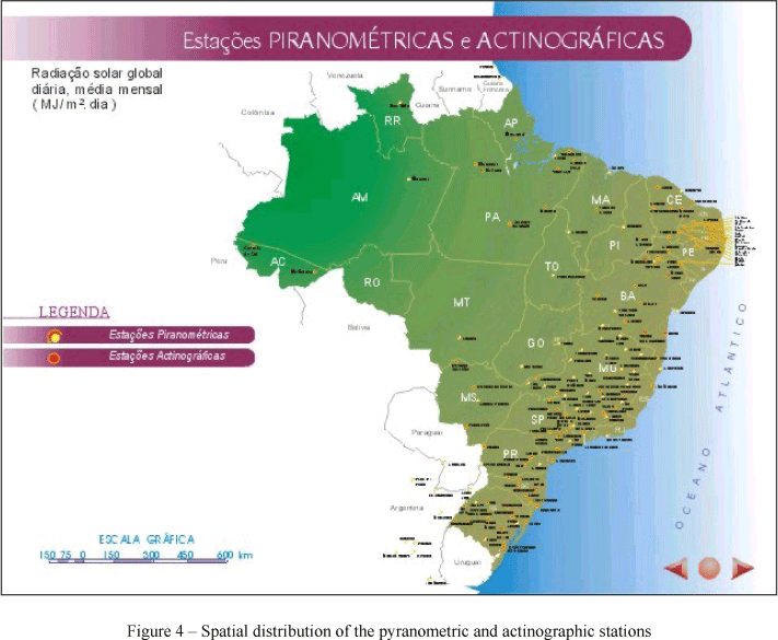
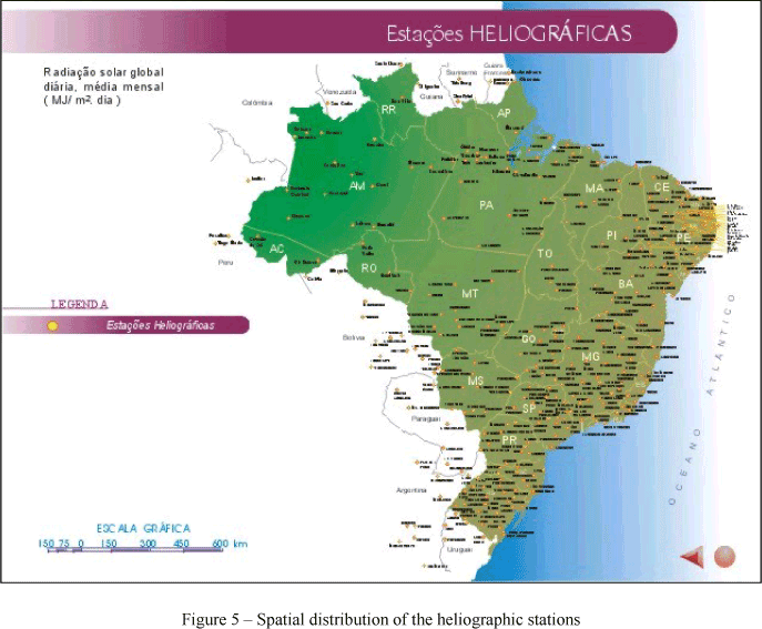
The Solar Resource database presents data from 567 stations provided either with heliographs, actinographs or pyranometers. Figure 4 shows the locations in Brazil where daily, monthly averaged, solar radiation records using pyranometers and actinographs were used. On the other hand, the locations where records of sunshine hours using Campbell-Stokes heliographs, are shown on Fig. 5.
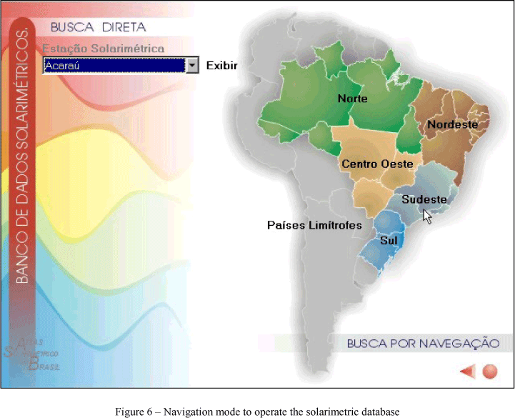
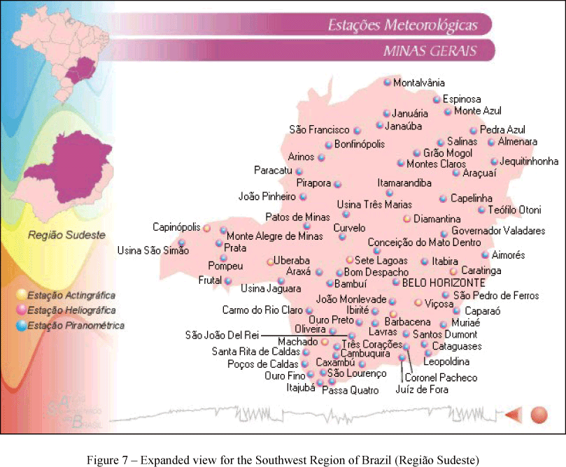
To run the database we can use either a "map" or a "station" navigation mode (Fig. 6). In the first mode the available stations can be chosen on the map by mouse clicking. In the second mode any geographical site can be designated with the computer keyboard. Figure 7 is an expanded view of the map navigation mode for the Southwest Region (Região Sudoeste).
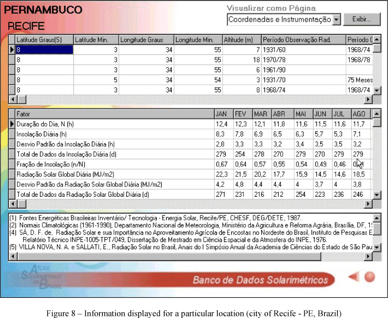
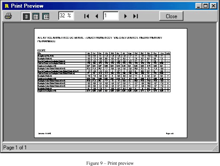
Solar radiation data for the city of Recife are displayed in Fig. 8 and a print preview in Fig. 9.
CALCULATION TOOL
The main features of the algorithm for solar radiation calculation, are:
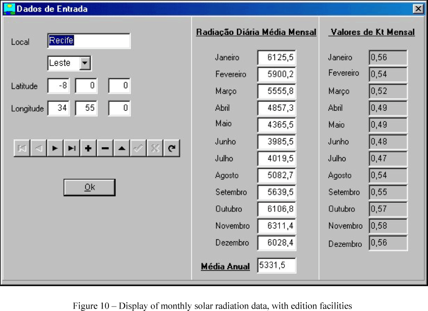
- A data bank with monthly solar radiation data, with edition facilities in order to extend the data base (Fig. 10);
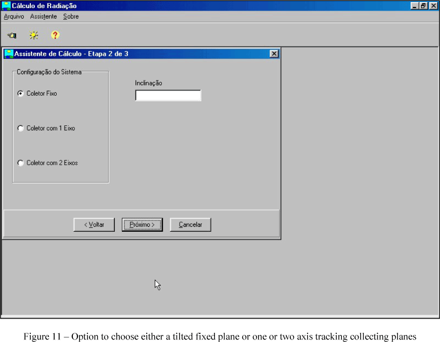
- Compute average hourly or daily solar radiation, incident at fixed planes with specified tilt angles or at the collection plane of one or two axis tracking devices, Fig. 11;
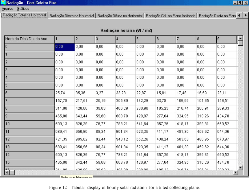
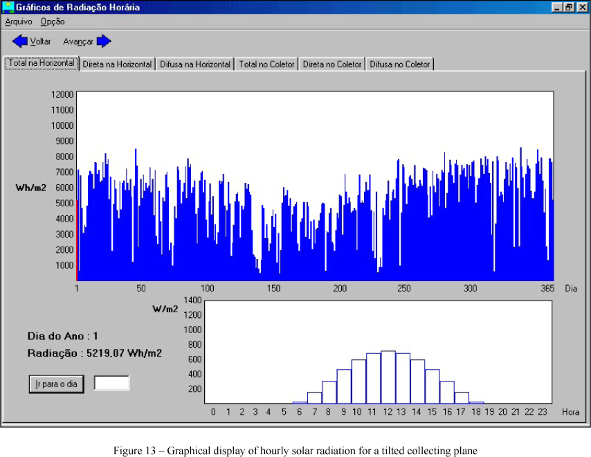
- Tabular and graphical display of hourly solar radiation and monthly average daily radiation, for fixed planes with specified tilt angles and collecting planes of one or two axis tracking devices, Figs. 12-13 ;
- A stochastic solar radiation data generator for hourly or daily time series sequences.
The required data is a set of 12, monthly average, daily global solar radiation values.
ACKNOWLEDGMENTS
This work was supported by the Centro de Pesquisas em Energia Elétrica (CEPEL-ELETROBRAS), Companhia Hidro-Elétrica do São Francisco (CHESF), XINGÓ PROGRAM and FACEPE-PE.
REFERENCES
[1] Tiba, C., Fraidenraich, N., Moskowicz, M., Cavalcanti, E. S. C., Lyra, F. J. M., Nogueira, A M. B. e Grossi Gallegos, H., Atlas Solarimétrico do Brasil, CD ROM, (2002), Editora Universitária da UFPE.
[2] Lyra, F. M., Fraidenraich, N., and Tiba, C. Solarimetry in Brazil - Status and Proposals, Technical Report - GTEF, 73 pp., Recife, 1993.
[3] IBGE (Instituto Brasileiro de Geografia e Estatística), Atlas Nacional do Brasil, sem data.
[4] Organización Meteorológica Mundial, Atlas Climático de América del Sur, Vol. I (J. Hoffmann), O.M.M., UNESCO, Cartographia, Budapest, Hungria, 28 Cartas, 1975.